
Red Cross Wildfire and Shelter Map
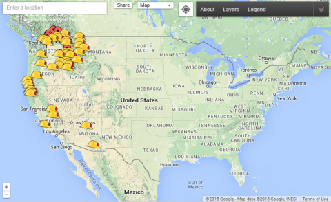
The below interactive map shows where wildfires are currently burning in the U.S.(link is external), as well as locations of Red Cross evacuation shelters(link is external). Click on the helmet icons to see information on specific fires. Information on fires includes the name of the wildfire, the location, and how much of the fire is contained. The pins on the map indicate where evacuees can find shelter(link is external), food, and emotional support from the Red Cross. Information on fires includes the name of the wildfire, the location, and how much of the fire is contained. Shelter information includes the address, capacity, and current population. Information is updated every 30 minutes. More information is available on the American Red Cross website(link is external).


Add new comment